Date: 18-Oct-2006 (Wednesday)
Location: Start at Pontneddfechan, Brecon Beacons
Length: 10 miles (approx 7hrs with stops)
Photos taken on the day
Pontneddfechan is on the A465 a few miles west of Merthyr Tydfil. We left Chipping Sodbury about 0740 and arrived at the Hotel Craig-y-Dinas about 0930 due to the rush hour traffic on the M4 & A470. The word 'Dinas' is Russian for 'firebrick' which is connected to the local industry mining for silica.
We had the agreement of the landlord of the hotel to leave our cars in his car park as a number of the group were intending to eat there upon our return.
The walk was advertised as 10 miles and using my GPS it recorded the trip as 9.6 which is pretty close. There were 17 or 18 in the group and Molly the dog. We started the walk at 1020 and arrived back at the hotel at 1735. We stopped a couple of times for a tea break and for about 45 minutes at lunchtime.
The weather was very kind to us and unseasonably mild being about 17celsius most of the day and dry.
Naturally with the path following the river containing waterfalls there was a fair amount of ascent & descent involved. My altimeter watch recorded this as starting at 92m and reaching 322m. I wasn't sure of the exact starting altitude but the watch was calibrated at home before we left.
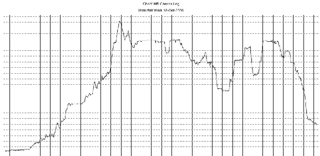
Download the altitude in PDF format, download the altitude & heart rate in PDF format.
The GPS track was recorded with two waypoints for the start and the lunch stop.
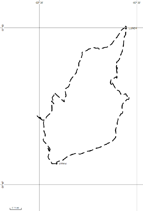
Download the GPS route & waypoints in GPX format.
Port Talbot County Borough Council has some information on the waterfalls in the Vale of Neath on their website. These pages also contain interesting information about the Gunpowder works that can be seen along the walk.
[home] [Walks Home]